


Pic d'esquine d'Ase et Pic de Nabre

petit-pied
User
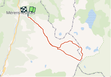

Length
14.9 km

Max alt
2653 m

Uphill gradient
1528 m
Km-Effort
35 km

Min alt
1182 m

Downhill gradient
1528 m
Boucle
Yes
Creation date :
2023-09-02 15:18:17.014
Updated on :
2023-09-02 15:19:16.865
8h01
Difficulty : Very difficult

FREE GPS app for hiking
 SityTrail
IGN / Geographical institutes
SityTrail Plus
The world is yours!
About
Trail Walking of 14.9 km to be discovered at Occitania, Ariège, Mérens-les-Vals. This trail is proposed by petit-pied.
Positioning
Country:
France
Region :
Occitania
Department/Province :
Ariège
Municipality :
Mérens-les-Vals
Location:
Unknown
Start:(Dec)
Start:(UTM)
405389 ; 4723213 (31T) N.
Comments