


CHABOTTES-TOUR CARRÉE

RD78-38
User
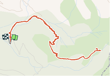

Length
8.6 km

Max alt
1784 m

Uphill gradient
452 m
Km-Effort
14.6 km

Min alt
1323 m

Downhill gradient
452 m
Boucle
Yes
Creation date :
2023-09-03 07:22:31.0
Updated on :
2023-09-03 13:20:48.898
3h03
Difficulty : Easy

FREE GPS app for hiking
 SityTrail
IGN / Geographical institutes
SityTrail Plus
The world is yours!
About
Trail Walking of 8.6 km to be discovered at Provence-Alpes-Côte d'Azur, Hautes-Alpes, Saint-Julien-en-Beauchêne. This trail is proposed by RD78-38.
Description
Parcours assez facile dans la forêt
Positioning
Country:
France
Region :
Provence-Alpes-Côte d'Azur
Department/Province :
Hautes-Alpes
Municipality :
Saint-Julien-en-Beauchêne
Location:
Unknown
Start:(Dec)
Start:(UTM)
719990 ; 4946360 (31T) N.
Comments