


03.09.23 Schnepfenried

delm
User
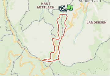

Length
12.4 km

Max alt
1307 m

Uphill gradient
347 m
Km-Effort
17 km

Min alt
1072 m

Downhill gradient
342 m
Boucle
Yes
Creation date :
2023-09-03 09:14:08.0
Updated on :
2023-09-03 13:44:41.507
3h30
Difficulty : Difficult

FREE GPS app for hiking
 SityTrail
IGN / Geographical institutes
SityTrail Plus
The world is yours!
About
Trail Walking of 12.4 km to be discovered at Grand Est, Haut-Rhin, Sondernach. This trail is proposed by delm.
Description
Magnifique randonnée
Belles vues et forêts
Positioning
Country:
France
Region :
Grand Est
Department/Province :
Haut-Rhin
Municipality :
Sondernach
Location:
Unknown
Start:(Dec)
Start:(UTM)
354292 ; 5316703 (32T) N.
Comments