


La Haute Levade

micheldutilleul
User

Length
6.5 km

Max alt
421 m

Uphill gradient
159 m
Km-Effort
8.6 km

Min alt
274 m

Downhill gradient
164 m
Boucle
Yes
Creation date :
2023-09-06 14:40:21.892
Updated on :
2023-09-06 16:46:39.123
2h05
Difficulty : Very easy

FREE GPS app for hiking
 SityTrail
IGN / Geographical institutes
SityTrail Plus
The world is yours!
About
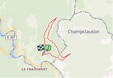
Trail Walking of 6.5 km to be discovered at Occitania, Gard, Sainte-Cécile-d'Andorge. This trail is proposed by micheldutilleul.
Positioning
Country:
France
Region :
Occitania
Department/Province :
Gard
Municipality :
Sainte-Cécile-d'Andorge
Location:
Unknown
Start:(Dec)
Start:(UTM)
579991 ; 4898401 (31T) N.
Comments