


Montoison

raygautier
User
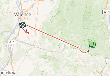

Length
69 km

Max alt
1080 m

Uphill gradient
4127 m
Km-Effort
125 km

Min alt
109 m

Downhill gradient
4492 m
Boucle
No
Creation date :
2023-09-07 14:06:58.0
Updated on :
2023-09-08 11:42:39.656
18h12
Difficulty : Very difficult

FREE GPS app for hiking
 SityTrail
IGN / Geographical institutes
SityTrail Plus
The world is yours!
About
Trail Walking of 69 km to be discovered at Auvergne-Rhône-Alpes, Drôme, Châtillon-en-Diois. This trail is proposed by raygautier.
Positioning
Country:
France
Region :
Auvergne-Rhône-Alpes
Department/Province :
Drôme
Municipality :
Châtillon-en-Diois
Location:
Châtillon-en-Diois
Start:(Dec)
Start:(UTM)
696950 ; 4951831 (31T) N.
Comments