


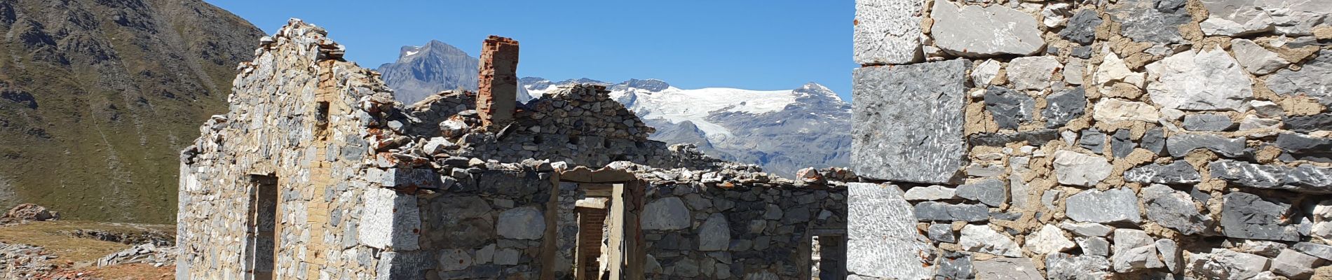
Montcenis lac fort de la Tura

janussity
User
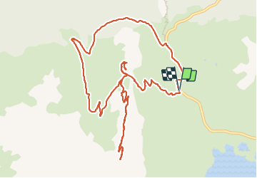

Length
14.2 km

Max alt
2688 m

Uphill gradient
717 m
Km-Effort
24 km

Min alt
1991 m

Downhill gradient
719 m
Boucle
Yes
Creation date :
2023-09-08 07:15:43.872
Updated on :
2023-09-08 13:27:21.371
4h06
Difficulty : Difficult

FREE GPS app for hiking
 SityTrail
IGN / Geographical institutes
SityTrail Plus
The world is yours!
About
Trail Walking of 14.2 km to be discovered at Auvergne-Rhône-Alpes, Savoy, Val-Cenis. This trail is proposed by janussity.
Description
beau temps
boucle évitée car éboulements
Photos


Positioning
Country:
France
Region :
Auvergne-Rhône-Alpes
Department/Province :
Savoy
Municipality :
Val-Cenis
Location:
Unknown
Start:(Dec)
Start:(UTM)
335265 ; 5013985 (32T) N.
Comments