


Broceliande_ 090923

d.rognon
User

Length
100 km

Max alt
135 m

Uphill gradient
1159 m
Km-Effort
115 km

Min alt
17 m

Downhill gradient
1159 m
Boucle
No
Creation date :
2023-09-09 13:45:09.082
Updated on :
2023-09-10 08:27:27.487
2h45
Difficulty : Very difficult

FREE GPS app for hiking
 SityTrail
IGN / Geographical institutes
SityTrail Plus
The world is yours!
About
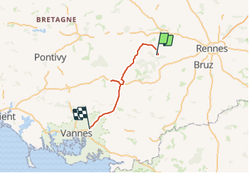
Trail Walking of 100 km to be discovered at Brittany, Ille-et-Vilaine, Paimpont. This trail is proposed by d.rognon.
Positioning
Country:
France
Region :
Brittany
Department/Province :
Ille-et-Vilaine
Municipality :
Paimpont
Location:
Unknown
Start:(Dec)
Start:(UTM)
565621 ; 5325305 (30U) N.
Comments