


de Villars à St jean

pln30
User
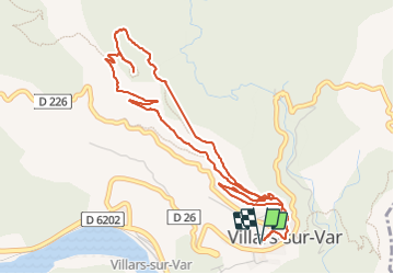

Length
6.2 km

Max alt
771 m

Uphill gradient
386 m
Km-Effort
11.3 km

Min alt
400 m

Downhill gradient
385 m
Boucle
Yes
Creation date :
2023-09-10 05:17:58.82
Updated on :
2023-09-10 09:34:17.679
1h58
Difficulty : Medium

FREE GPS app for hiking
 SityTrail
IGN / Geographical institutes
SityTrail Plus
The world is yours!
About
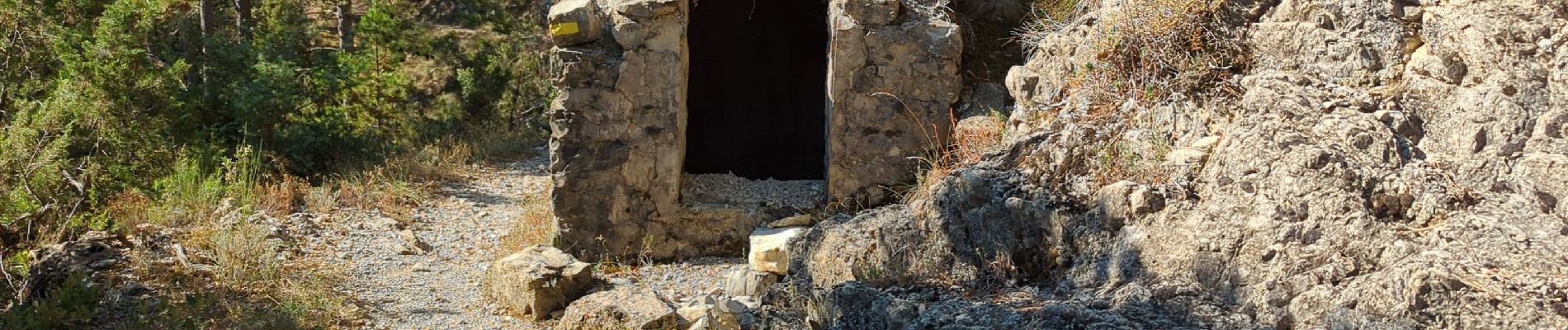
Trail Walking of 6.2 km to be discovered at Provence-Alpes-Côte d'Azur, Maritime Alps, Villars-sur-Var. This trail is proposed by pln30.
Photos


Positioning
Country:
France
Region :
Provence-Alpes-Côte d'Azur
Department/Province :
Maritime Alps
Municipality :
Villars-sur-Var
Location:
Unknown
Start:(Dec)
Start:(UTM)
347148 ; 4866566 (32T) N.
Comments