Trail Walking L'Albère - de Saint Martin au Neoulous  - Photo

de Saint Martin au Neoulous

© OpenStreetMap contributors
Length
Length
13.2 km
Max alt
Max alt
1243 m
Uphill gradient
Uphill gradient
666 m
Km-Effort
Km-Effort  
22 km
Min alt
Min alt
626 m
Downhill gradient
Downhill gradient
665 m
Boucle
Boucle
Yes
Creation date :
2023-09-12 09:40:27.535
Updated on :
2023-09-12 09:40:28.661

(0 Reviews)

Walking
Walking
5h01
Difficulty : Medium

Scan this QR Code to open this trail in the SityTrail application

FREE GPS app for hiking

Logo SityTrail SityTrail

IGN / Geographical institutes

Download SityTrail from the App Store Download SityTrail from Google Play

Logo SityTrail SityTrail World

The world is yours!

Download SityTrail from the App Store Download SityTrail from Google Play Download SityTrail on Huawei AppGallery

About

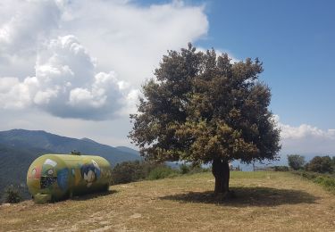
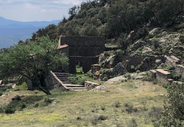
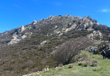
Trail Walking of 13.2 km to be discovered at Occitania, Pyrénées-Orientales, L'Albère. This trail is proposed by Denis Delay.

Description

saint Martin, coll forçat, roc des trois termes, puits à neige, Neoulous, col de l'Ouillat, roca corba, saint Martin.

Elevation profile

Positioning

Country:
France
Region :
Occitania
Department/Province :
Pyrénées-Orientales
Municipality :
L'Albère
Location:
Unknown
Start:(UTM)
492467 ; 4701635 (31T) N.

Trails nearby

Trail Walking L'Albère - SAINT-JEAN-D'ALBERE 66 - PUIG  de Sant Christau par le coll de Sant Joan  - Photo
Walking
jeff66

Walking

Difficult
(1)
L'Albère, Occitania, Pyrénées-Orientales, France
10.1 km | 17 km-effort
2h 46min
Yes
Trail Walking Sorède - Utrera Font Miracles T - Photo
Walking
force

Walking

Medium
(1)
Sorède, Occitania, Pyrénées-Orientales, France
10.7 km | 17.6 km-effort
3h 50min
Yes
Trail Walking Sorède - 577. 11km sorede roc des medes  - Photo
Walking
Erius

Walking

Medium
(1)
Sorède, Occitania, Pyrénées-Orientales, France
10.5 km | 18.2 km-effort
3h 42min
Yes
Trail On foot Sorède - Vallée Heureuse - Château d'Ultrera - Photo
On foot
PRO

On foot

Easy
Sorède, Occitania, Pyrénées-Orientales, France
10.9 km | 19.4 km-effort
4h 23min
Yes
Trail Walking Sorède - RP66 SOREDE VALLÉE HEUREUSE - COL DES 4 TERMES - LE 17.11.2016  - Photo
Walking
jeff66

Walking

Difficult
(2)
Sorède, Occitania, Pyrénées-Orientales, France
19.4 km | 33 km-effort
5h 26min
Yes
Trail Walking L'Albère - Le Pic Neulos (1256m) - Photo
Walking
philturp

Walking

Easy
(1)
L'Albère, Occitania, Pyrénées-Orientales, France
7.7 km | 12.2 km-effort
2h 46min
Yes
Trail Walking la Jonquera - 20230427 au départ du Perthus-crash DC6 1986 - Photo
Walking
ThonyM

Walking

Difficult
la Jonquera, Catalonia, Girona, Spain
13.9 km | 21 km-effort
3h 54min
Yes
Trail Walking L'Albère - Col de l’outillage  - Photo
Walking
ombrabella

Walking

Easy
L'Albère, Occitania, Pyrénées-Orientales, France
11.5 km | 17.2 km-effort
3h 23min
Yes
Trail Walking Sorède - Vallee-heureuse-Ermitage-Chateau-ultrera_T - Photo
Walking
force

Walking

Difficult
Sorède, Occitania, Pyrénées-Orientales, France
10.6 km | 18.7 km-effort
3h 43min
Yes


Close
My subscriptions