Trail Walking Saint-Gervais-les-Bains - CHAMONIX (Mont-Blanc) - Photo
© OpenStreetMap contributors
Length
Length
3.7 km
Max alt
Max alt
4794 m
Uphill gradient
Uphill gradient
1116 m
Km-Effort
Km-Effort  
15.3 km
Min alt
Min alt
3706 m
Downhill gradient
Downhill gradient
138 m
Boucle
Boucle
No
Creation date :
2017-04-11 00:00:00.0
Updated on :
2017-04-11 00:00:00.0

(0 Reviews)

Walking
Walking
3h18
Difficulty : Very difficult

Scan this QR Code to open this trail in the SityTrail application

FREE GPS app for hiking

Logo SityTrail SityTrail

IGN / Geographical institutes

Download SityTrail from the App Store Download SityTrail from Google Play

Logo SityTrail SityTrail World

The world is yours!

Download SityTrail from the App Store Download SityTrail from Google Play Download SityTrail on Huawei AppGallery

About

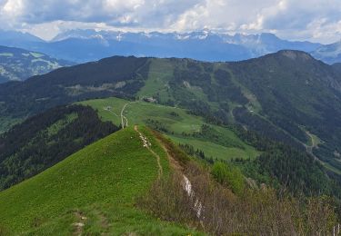
Trail Walking of 3.7 km to be discovered at Auvergne-Rhône-Alpes, Upper Savoy, Saint-Gervais-les-Bains. This trail is proposed by GerardBouche.

Description

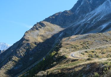
Refuge du Goûter vers l'Aiguille, le Dôme, le Col, une pause au refuge Vallot puis ascension par les Bosses jusqu'au Mt-Blanc.

Elevation profile

Positioning

Country:
France
Region :
Auvergne-Rhône-Alpes
Department/Province :
Upper Savoy
Municipality :
Saint-Gervais-les-Bains
Location:
Unknown
Start:(UTM)
331552 ; 5080007 (32T) N.

Trails nearby

Trail Other activity Chamonix-Mont-Blanc - vallée blanche - Photo
Other activity
jnpollet

Other activity

Difficult
(1)
Chamonix-Mont-Blanc, Auvergne-Rhône-Alpes, Upper Savoy, France
19.8 km | 30 km-effort
3h 21min
No
Trail Walking Saint-Gervais-les-Bains - Descente au Glacier de Bionnassay depuis le Nid d''Aigle - Photo
Walking
GUIDE
pscheven

Walking

Very easy
(1)
Saint-Gervais-les-Bains, Auvergne-Rhône-Alpes, Upper Savoy, France
839 m | 1.9 km-effort
28min
No
Trail Walking Les Houches - Maison Neuve (Les Houches) boucle par Bellevue et Mont  Lachat - Photo
Walking
ScarniereLaurent

Walking

Difficult
Les Houches, Auvergne-Rhône-Alpes, Upper Savoy, France
13.6 km | 27 km-effort
4h 0min
Yes
Trail Walking Chamonix-Mont-Blanc - Chalet des Pyramides 1895m 11.7.22 - Photo
Walking
fredetpascale

Walking

Medium
Chamonix-Mont-Blanc, Auvergne-Rhône-Alpes, Upper Savoy, France
7.7 km | 15.2 km-effort
3h 30min
Yes
Trail On foot Courmayeur - The Three Monts - Photo
On foot
PRO

On foot

Easy
Courmayeur, Aosta Valley, Unknown, Italy
7 km | 15.8 km-effort
3h 36min
No
Trail On foot Saint-Gervais-les-Bains - The Goûter - Photo
On foot
PRO

On foot

Easy
Saint-Gervais-les-Bains, Auvergne-Rhône-Alpes, Upper Savoy, France
8.8 km | 13.4 km-effort
3h 2min
No
Trail Snowshoes Saint-Gervais-les-Bains - refuge de tête rousse - Photo
Snowshoes
jeff2

Snowshoes

Difficult
Saint-Gervais-les-Bains, Auvergne-Rhône-Alpes, Upper Savoy, France
4.9 km | 13.9 km-effort
4h 14min
No
Trail Other activity Chamonix-Mont-Blanc - la jonction  - Photo
Other activity
jeff2

Other activity

Very easy
Chamonix-Mont-Blanc, Auvergne-Rhône-Alpes, Upper Savoy, France
13.7 km | 33 km-effort
7h 36min
No
Trail Walking Les Houches - CHAMONIX (Les Houches) - Photo
Walking
GerardBouche

Walking

Easy
Les Houches, Auvergne-Rhône-Alpes, Upper Savoy, France
10.3 km | 13.4 km-effort
2h 48min
No


Close
My subscriptions