


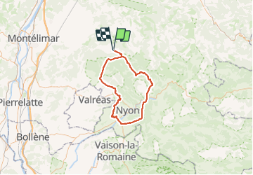
Dieulefit 85km

thonyc
User GUIDE

Length
84 km

Max alt
740 m

Uphill gradient
1457 m
Km-Effort
103 km

Min alt
221 m

Downhill gradient
1456 m
Boucle
Yes
Creation date :
2023-09-16 07:20:29.562
Updated on :
2023-09-16 07:22:04.294
4h00
Difficulty : Medium

FREE GPS app for hiking
 SityTrail
IGN / Geographical institutes
SityTrail Plus
The world is yours!
About
Trail Cycle of 84 km to be discovered at Auvergne-Rhône-Alpes, Drôme, Dieulefit. This trail is proposed by thonyc.
Positioning
Country:
France
Region :
Auvergne-Rhône-Alpes
Department/Province :
Drôme
Municipality :
Dieulefit
Location:
Unknown
Start:(Dec)
Start:(UTM)
663944 ; 4932076 (31T) N.
Comments