


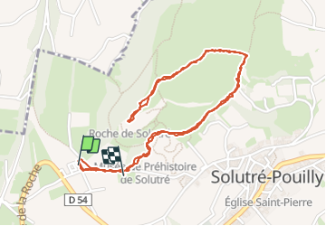
La roche de Solutré

alainjoseph6
User

Length
3.4 km

Max alt
464 m

Uphill gradient
111 m
Km-Effort
4.8 km

Min alt
382 m

Downhill gradient
108 m
Boucle
Yes
Creation date :
2023-09-16 08:18:19.479
Updated on :
2023-09-16 10:17:32.303
1h17
Difficulty : Easy

FREE GPS app for hiking
 SityTrail
IGN / Geographical institutes
SityTrail Plus
The world is yours!
About
Trail Walking of 3.4 km to be discovered at Bourgogne-Franche-Comté, Saône-et-Loire, Solutré-Pouilly. This trail is proposed by alainjoseph6.
Description
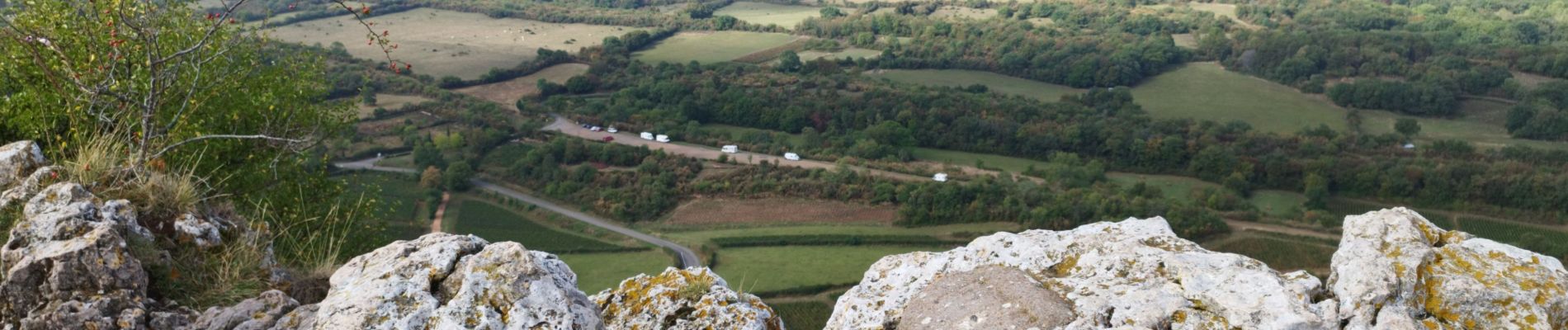
une magnifique balade à faire en famille.
Une vue à 360 degrés extraordinaire.
Photos


Positioning
Country:
France
Region :
Bourgogne-Franche-Comté
Department/Province :
Saône-et-Loire
Municipality :
Solutré-Pouilly
Location:
Unknown
Start:(Dec)
Start:(UTM)
632137 ; 5128509 (31T) N.
Comments