


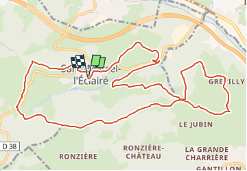
Amicale_StMarcel_14Kms

d.rognon
User

Length
14.4 km

Max alt
707 m

Uphill gradient
396 m
Km-Effort
19.6 km

Min alt
456 m

Downhill gradient
392 m
Boucle
Yes
Creation date :
2023-09-17 14:13:15.232
Updated on :
2024-02-22 09:05:07.727
4h27
Difficulty : Very difficult

FREE GPS app for hiking
 SityTrail
IGN / Geographical institutes
SityTrail Plus
The world is yours!
About
Trail Walking of 14.4 km to be discovered at Auvergne-Rhône-Alpes, Rhône, Saint-Marcel-l'Éclairé. This trail is proposed by d.rognon.
Description
Sur une proposition de Jo DUBESSY
Randonnée faite le 19 septembre 2023
Positioning
Country:
France
Region :
Auvergne-Rhône-Alpes
Department/Province :
Rhône
Municipality :
Saint-Marcel-l'Éclairé
Location:
Unknown
Start:(Dec)
Start:(UTM)
611272 ; 5081147 (31T) N.
Comments