


Tour du pic du pin

michel.pegaz
User
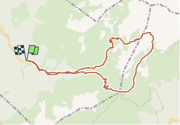

Length
12 km

Max alt
2274 m

Uphill gradient
990 m
Km-Effort
25 km

Min alt
1358 m

Downhill gradient
974 m
Boucle
Yes
Creation date :
2023-09-21 06:30:15.0
Updated on :
2023-10-02 07:45:56.706

FREE GPS app for hiking
 SityTrail
IGN / Geographical institutes
SityTrail Plus
The world is yours!
About
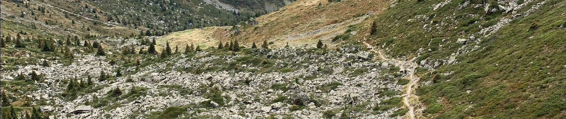
Trail of 12 km to be discovered at Auvergne-Rhône-Alpes, Isère, Laval-en-Belledonne. This trail is proposed by michel.pegaz.
Photos


31 photos in total. Please click on a photo to see them all in the gallery.
Positioning
Country:
France
Region :
Auvergne-Rhône-Alpes
Department/Province :
Isère
Municipality :
Laval-en-Belledonne
Location:
Unknown
Start:(Dec)
Start:(UTM)
735329 ; 5012347 (31T) N.
Comments