


fietsnet230925

ochelen
User
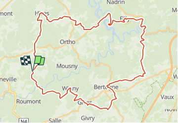

Length
50 km

Max alt
483 m

Uphill gradient
1035 m
Km-Effort
63 km

Min alt
263 m

Downhill gradient
1038 m
Boucle
Yes
Creation date :
2023-09-25 13:01:28.075
Updated on :
2023-09-25 13:10:47.303

FREE GPS app for hiking
 SityTrail
IGN / Geographical institutes
SityTrail Plus
The world is yours!
About
Trail of 50 km to be discovered at Wallonia, Luxembourg, Tenneville. This trail is proposed by ochelen.
Positioning
Country:
Belgium
Region :
Wallonia
Department/Province :
Luxembourg
Municipality :
Tenneville
Location:
Unknown
Start:(Dec)
Start:(UTM)
683494 ; 5552678 (31U) N.
Comments