


Du lac de MISON à celui du Poet par les colombettes

babouille
User
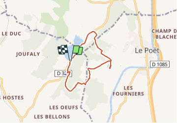

Length
5.7 km

Max alt
677 m

Uphill gradient
80 m
Km-Effort
6.8 km

Min alt
627 m

Downhill gradient
83 m
Boucle
Yes
Creation date :
2023-09-29 06:57:23.0
Updated on :
2023-09-29 08:40:53.075

FREE GPS app for hiking
 SityTrail
IGN / Geographical institutes
SityTrail Plus
The world is yours!
About
Trail of 5.7 km to be discovered at Provence-Alpes-Côte d'Azur, Alpes-de-Haute-Provence, Mison. This trail is proposed by babouille.
Description
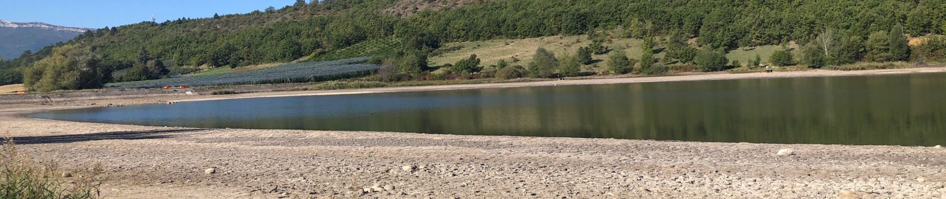
Départ au Parking du lac de MISON monter par le sentier à l’est aux colmbettes rejoindre le réservoir du Poet redescendre par le nord et rejoindre le parking par la route
Photos


Positioning
Country:
France
Region :
Provence-Alpes-Côte d'Azur
Department/Province :
Alpes-de-Haute-Provence
Municipality :
Mison
Location:
Unknown
Start:(Dec)
Start:(UTM)
729064 ; 4907999 (31T) N.
Comments