


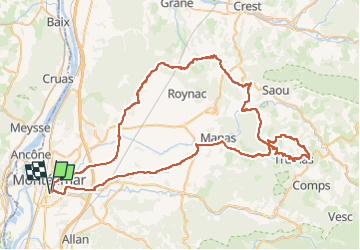
Tartéguille Pascalin 92km

thonyc
User GUIDE

Length
92 km

Max alt
686 m

Uphill gradient
1365 m
Km-Effort
111 km

Min alt
83 m

Downhill gradient
1365 m
Boucle
Yes
Creation date :
2023-10-01 19:08:24.694
Updated on :
2024-03-18 12:08:13.245
6h42
Difficulty : Very difficult

FREE GPS app for hiking
 SityTrail
IGN / Geographical institutes
SityTrail Plus
The world is yours!
About
Trail Road bike of 92 km to be discovered at Auvergne-Rhône-Alpes, Drôme, Montélimar. This trail is proposed by thonyc.
Positioning
Country:
France
Region :
Auvergne-Rhône-Alpes
Department/Province :
Drôme
Municipality :
Montélimar
Location:
Unknown
Start:(Dec)
Start:(UTM)
639184 ; 4933840 (31T) N.
Comments