


corbel les egaux

pierrounet
User

Length
7.3 km

Max alt
1023 m

Uphill gradient
318 m
Km-Effort
11.6 km

Min alt
755 m

Downhill gradient
319 m
Boucle
Yes
Creation date :
2023-10-02 11:37:15.884
Updated on :
2023-10-02 13:55:50.614
2h18
Difficulty : Medium

FREE GPS app for hiking
 SityTrail
IGN / Geographical institutes
SityTrail Plus
The world is yours!
About
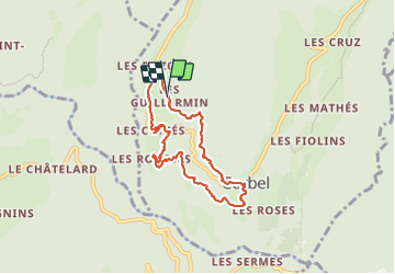
Trail Walking of 7.3 km to be discovered at Auvergne-Rhône-Alpes, Savoy, Corbel. This trail is proposed by pierrounet.
Positioning
Country:
France
Region :
Auvergne-Rhône-Alpes
Department/Province :
Savoy
Municipality :
Corbel
Location:
Unknown
Start:(Dec)
Start:(UTM)
719968 ; 5035579 (31T) N.
Comments