


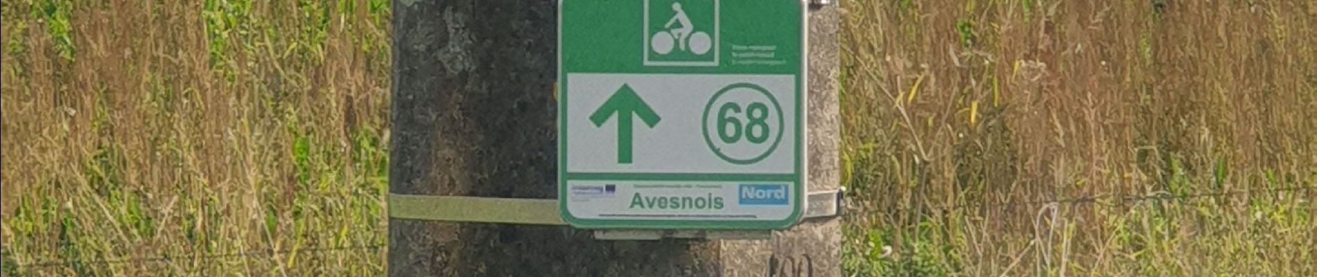
balisage 2 PR Avesnois octobre 2023

jeanluc59
User
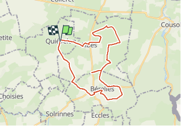

Length
16 km

Max alt
233 m

Uphill gradient
168 m
Km-Effort
18.2 km

Min alt
179 m

Downhill gradient
167 m
Boucle
Yes
Creation date :
2023-10-04 07:51:40.306
Updated on :
2023-10-06 09:20:56.063
4h08
Difficulty : Difficult

FREE GPS app for hiking
 SityTrail
IGN / Geographical institutes
SityTrail Plus
The world is yours!
About
Trail Walking of 16 km to be discovered at Hauts-de-France, Nord, Quiévelon. This trail is proposed by jeanluc59.
Description
circuit du bois de fagne
circuit du bout-là-haut
Photos


Positioning
Country:
France
Region :
Hauts-de-France
Department/Province :
Nord
Municipality :
Quiévelon
Location:
Unknown
Start:(Dec)
Start:(UTM)
576615 ; 5565635 (31U) N.
Comments