


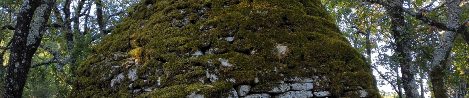
Saignon, Auribeau, Castellet & Rocher des Abeilles

MarcLEBARON
User
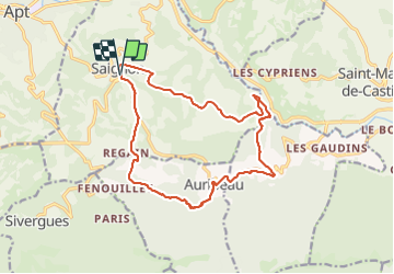

Length
17 km

Max alt
715 m

Uphill gradient
582 m
Km-Effort
25 km

Min alt
273 m

Downhill gradient
582 m
Boucle
Yes
Creation date :
2023-10-06 06:34:36.215
Updated on :
2023-12-02 15:35:44.604
5h17
Difficulty : Difficult

FREE GPS app for hiking
 SityTrail
IGN / Geographical institutes
SityTrail Plus
The world is yours!
About
Trail Walking of 17 km to be discovered at Provence-Alpes-Côte d'Azur, Vaucluse, Saignon. This trail is proposed by MarcLEBARON.
Photos


Positioning
Country:
France
Region :
Provence-Alpes-Côte d'Azur
Department/Province :
Vaucluse
Municipality :
Saignon
Location:
Unknown
Start:(Dec)
Start:(UTM)
695264 ; 4859353 (31T) N.
Comments