


Saint

raygautier
User

Length
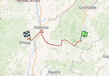
166 km

Max alt
1881 m

Uphill gradient
3717 m
Km-Effort
220 km

Min alt
91 m

Downhill gradient
4997 m
Boucle
No
Creation date :
2023-10-05 09:21:49.0
Updated on :
2023-10-08 13:35:41.665

FREE GPS app for hiking
 SityTrail
IGN / Geographical institutes
SityTrail Plus
The world is yours!
About
Trail of 166 km to be discovered at Auvergne-Rhône-Alpes, Drôme, Châtillon-en-Diois. This trail is proposed by raygautier.
Positioning
Country:
France
Region :
Auvergne-Rhône-Alpes
Department/Province :
Drôme
Municipality :
Châtillon-en-Diois
Location:
Treschenu-Creyers
Start:(Dec)
Start:(UTM)
705978 ; 4959243 (31T) N.
Comments