


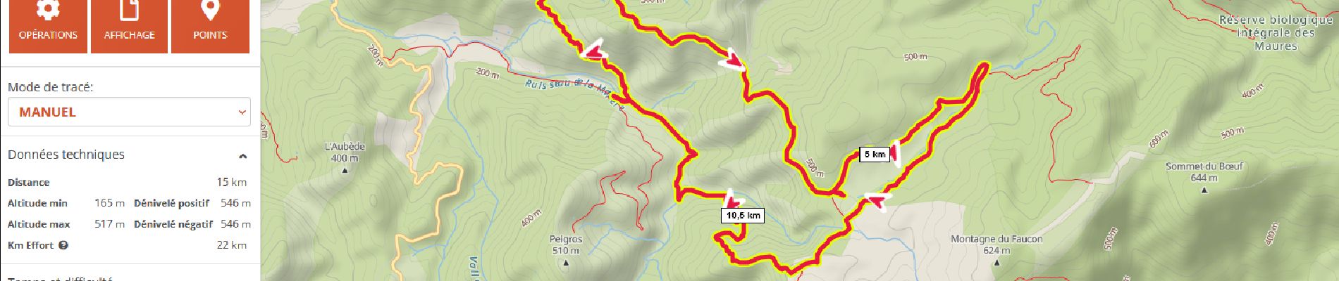
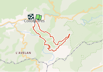
plateau Lambert en partant de Collobrieres

FSantoni
User

Length
15.2 km

Max alt
517 m

Uphill gradient
546 m
Km-Effort
22 km

Min alt
165 m

Downhill gradient
546 m
Boucle
Yes
Creation date :
2023-10-08 06:50:04.526
Updated on :
2023-10-08 16:58:22.623
6h58
Difficulty : Very difficult

FREE GPS app for hiking
 SityTrail
IGN / Geographical institutes
SityTrail Plus
The world is yours!
About
Trail Walking of 15.2 km to be discovered at Provence-Alpes-Côte d'Azur, Var, Collobrières. This trail is proposed by FSantoni.
Description
Très belle rando, avec un dénivelé intéressant réparti sur tout le trajet, et des paysages magnifiques
Photos


Positioning
Country:
France
Region :
Provence-Alpes-Côte d'Azur
Department/Province :
Var
Municipality :
Collobrières
Location:
Unknown
Start:(Dec)
Start:(UTM)
281533 ; 4790397 (32T) N.
Comments