


l Aiguille, le Devoluy ,jour 1

okfred26
User

Length
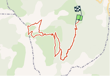
13.8 km

Max alt
2029 m

Uphill gradient
964 m
Km-Effort
27 km

Min alt
1065 m

Downhill gradient
986 m
Boucle
No
Creation date :
2023-10-11 07:06:42.681
Updated on :
2023-11-18 18:51:29.837
6h05
Difficulty : Very difficult

FREE GPS app for hiking
 SityTrail
IGN / Geographical institutes
SityTrail Plus
The world is yours!
About
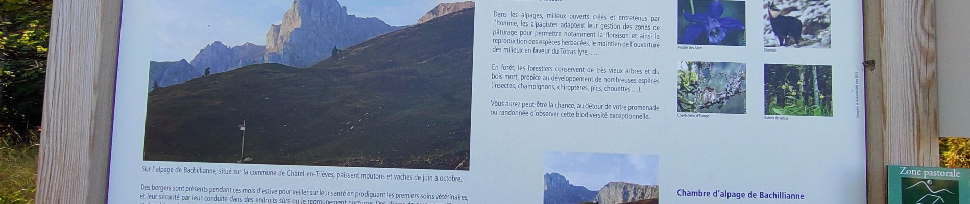
Trail Walking of 13.8 km to be discovered at Auvergne-Rhône-Alpes, Isère, Châtel-en-Trièves. This trail is proposed by okfred26.
Photos


Positioning
Country:
France
Region :
Auvergne-Rhône-Alpes
Department/Province :
Isère
Municipality :
Châtel-en-Trièves
Location:
Cordéac
Start:(Dec)
Start:(UTM)
725434 ; 4965041 (31T) N.
Comments