


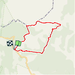
34 - Col de l' Ourtiguas - Ruines Caissenols - Portail de Roquandouir - 7,3 km - 2h30.gpx

dansmabulle34
User

Length
7.3 km

Max alt
1084 m

Uphill gradient
428 m
Km-Effort
13 km

Min alt
676 m

Downhill gradient
426 m
Boucle
Yes
Creation date :
2015-04-18 00:00:00.0
Updated on :
2015-04-18 00:00:00.0
2h46
Difficulty : Medium

FREE GPS app for hiking
 SityTrail
IGN / Geographical institutes
SityTrail Plus
The world is yours!
About
Trail Walking of 7.3 km to be discovered at Occitania, Hérault, Rosis. This trail is proposed by dansmabulle34.
Positioning
Country:
France
Region :
Occitania
Department/Province :
Hérault
Municipality :
Rosis
Location:
Unknown
Start:(Dec)
Start:(UTM)
497513 ; 4831866 (31T) N.
Comments