


34 - Douch - Caroux - 11,4 km - 4h30.gpx

dansmabulle34
User
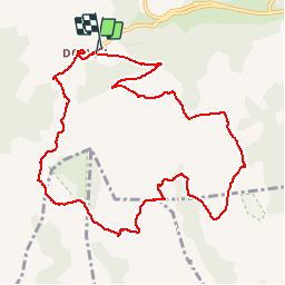

Length
11.4 km

Max alt
1090 m

Uphill gradient
421 m
Km-Effort
17.1 km

Min alt
883 m

Downhill gradient
433 m
Boucle
Yes
Creation date :
2015-04-18 00:00:00.0
Updated on :
2015-04-18 00:00:00.0
3h35
Difficulty : Medium

FREE GPS app for hiking
 SityTrail
IGN / Geographical institutes
SityTrail Plus
The world is yours!
About
Trail Walking of 11.4 km to be discovered at Occitania, Hérault, Rosis. This trail is proposed by dansmabulle34.
Points of interest


Positioning
Country:
France
Region :
Occitania
Department/Province :
Hérault
Municipality :
Rosis
Location:
Unknown
Start:(Dec)
Start:(UTM)
498037 ; 4828646 (31T) N.
Comments