


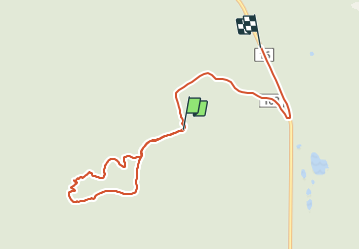

4.5 km | 7 km-effort


User


FREE GPS app for hiking
 SityTrail
IGN / Geographical institutes
SityTrail World
The world is yours!
Trail Walking of 7.8 km to be discovered at Quebec, La Haute-Gaspésie, Mont-Albert. This trail is proposed by s0c7.
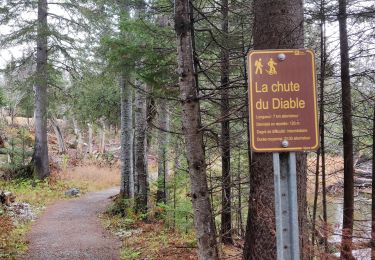
Balade très facile avec un faible dénivelé donnant une vue 360° sur les monts du parc de Gaspésie.
Vaut le détour...

Walking
Walking
Walking
Walking
Walking
Walking
Walking
Walking
Walking