


Embates et Castelmaure

robertperello
User
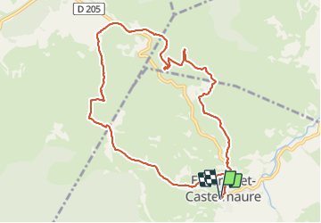

Length
11.1 km

Max alt
334 m

Uphill gradient
345 m
Km-Effort
15.7 km

Min alt
168 m

Downhill gradient
345 m
Boucle
Yes
Creation date :
2023-10-18 07:30:58.0
Updated on :
2023-10-19 18:39:43.957
3h16
Difficulty : Difficult

FREE GPS app for hiking
 SityTrail
IGN / Geographical institutes
SityTrail Plus
The world is yours!
About
Trail Walking of 11.1 km to be discovered at Occitania, Aude, Embres-et-Castelmaure. This trail is proposed by robertperello.
Description
Pking au foyer rural
Positioning
Country:
France
Region :
Occitania
Department/Province :
Aude
Municipality :
Embres-et-Castelmaure
Location:
Unknown
Start:(Dec)
Start:(UTM)
484643 ; 4754015 (31T) N.
Comments