


racou - risque de portails (par les bois) port argeles (par la mer) le racou

stef789
User GUIDE
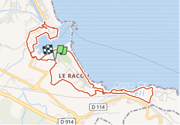

Length
7.1 km

Max alt
30 m

Uphill gradient
77 m
Km-Effort
8.1 km

Min alt
-1 m

Downhill gradient
78 m
Boucle
Yes
Creation date :
2023-10-22 14:00:28.481
Updated on :
2023-10-22 16:02:34.796
1h31
Difficulty : Easy

FREE GPS app for hiking
 SityTrail
IGN / Geographical institutes
SityTrail Plus
The world is yours!
About
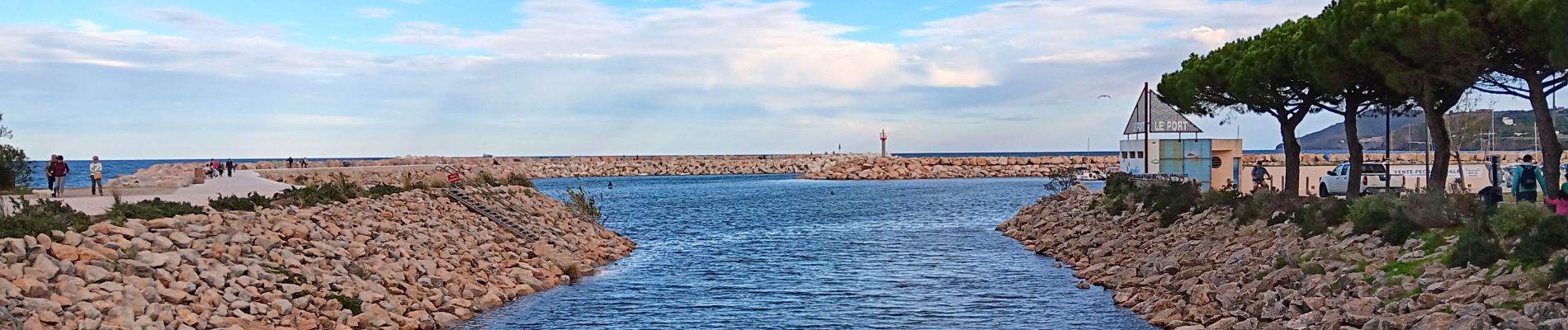
Trail Walking of 7.1 km to be discovered at Occitania, Pyrénées-Orientales, Argelès-sur-Mer. This trail is proposed by stef789.
Photos
 port argeles (par la mer) le racou - Photo 1")
 port argeles (par la mer) le racou - Photo 2")
 port argeles (par la mer) le racou - Photo 3")
 port argeles (par la mer) le racou - Photo 4")
 port argeles (par la mer) le racou - Photo 5")
 port argeles (par la mer) le racou - Photo 6")
 port argeles (par la mer) le racou - Photo 7")
 port argeles (par la mer) le racou - Photo 8")
 port argeles (par la mer) le racou - Photo 9")
 port argeles (par la mer) le racou - Photo 10")
 port argeles (par la mer) le racou - Photo 11")
 port argeles (par la mer) le racou - Photo 12")
 port argeles (par la mer) le racou - Photo 13")
 port argeles (par la mer) le racou - Photo 14")
 port argeles (par la mer) le racou - Photo 15")
 port argeles (par la mer) le racou - Photo 16")
Positioning
Country:
France
Region :
Occitania
Department/Province :
Pyrénées-Orientales
Municipality :
Argelès-sur-Mer
Location:
Unknown
Start:(Dec)
Start:(UTM)
504215 ; 4709620 (31T) N.
Comments