Trail Walking Volonne - 
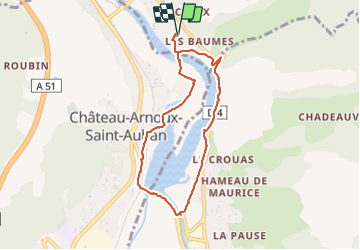
Tour du lac de Volonne - Photo
© OpenStreetMap contributors
Length
Length
7.5 km
Max alt
Max alt
452 m
Uphill gradient
Uphill gradient
71 m
Km-Effort
Km-Effort  
8.4 km
Min alt
Min alt
412 m
Downhill gradient
Downhill gradient
71 m
Boucle
Boucle
Yes
Creation date :
2023-10-23 12:08:02.0
Updated on :
2023-10-25 15:46:43.678

(0 Reviews)

Walking
Walking
1h54
Difficulty : Medium

Scan this QR Code to open this trail in the SityTrail application

FREE GPS app for hiking

Logo SityTrail SityTrail

IGN / Geographical institutes

Download SityTrail from the App Store Download SityTrail from Google Play

Logo SityTrail SityTrail Plus

The world is yours!

Download SityTrail from the App Store Download SityTrail from Google Play Download SityTrail on Huawei AppGallery

About

Trail Walking of 7.5 km to be discovered at Provence-Alpes-Côte d'Azur, Alpes-de-Haute-Provence, Volonne. This trail is proposed by babouille.

Description

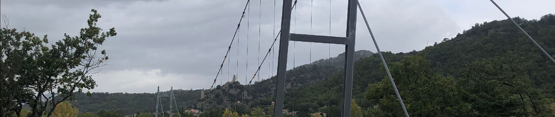
Se garer au Parking du Camping de L'Escale ,  rejoindre la passerelle au bord du lac sans la prendre , suivre le sentier à gauche ( sud ) qui surplombe une zone humide . le sentier suit un moment la route sans la croiser . le balisage par des bornes (voir la photo ) est précis . Aller jusqu'au pont qui enjambe la Durance sur le barrage (photo) Poursuivre vers le nord le sentier bien balisé jusqu'à la passerelle qui nous ramène au parking.

Elevation profile

Photos

Positioning

Country:
France
Region :
Provence-Alpes-Côte d'Azur
Department/Province :
Alpes-de-Haute-Provence
Municipality :
Volonne
Location:
Unknown
Start:(UTM)
261270 ; 4887863 (32T) N.


Close
My subscriptions