


Tête de la Chaudière

okfred26
User
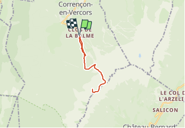

Length
9.9 km

Max alt
2014 m

Uphill gradient
823 m
Km-Effort
21 km

Min alt
1236 m

Downhill gradient
825 m
Boucle
Yes
Creation date :
2023-10-28 18:30:37.661
Updated on :
2023-10-28 18:30:40.469
4h44
Difficulty : Difficult

FREE GPS app for hiking
 SityTrail
IGN / Geographical institutes
SityTrail Plus
The world is yours!
About
Trail Walking of 9.9 km to be discovered at Auvergne-Rhône-Alpes, Isère, Corrençon-en-Vercors. This trail is proposed by okfred26.
Positioning
Country:
France
Region :
Auvergne-Rhône-Alpes
Department/Province :
Isère
Municipality :
Corrençon-en-Vercors
Location:
Unknown
Start:(Dec)
Start:(UTM)
699343 ; 4988123 (31T) N.
Comments