


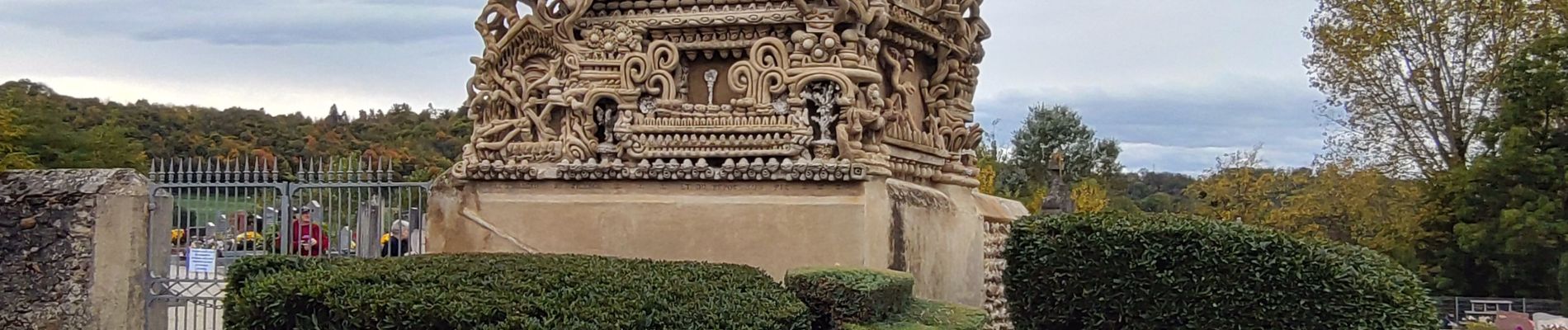
reco rando facteur CHEVAL/Hauterives

okfred26
User
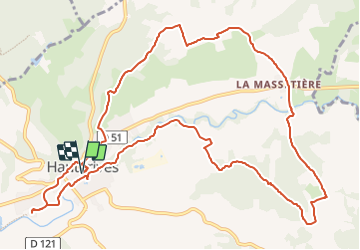

Length
14.4 km

Max alt
443 m

Uphill gradient
295 m
Km-Effort
18.3 km

Min alt
291 m

Downhill gradient
294 m
Boucle
Yes
Creation date :
2023-11-01 09:22:14.274
Updated on :
2023-11-01 18:11:44.045
4h09
Difficulty : Difficult

FREE GPS app for hiking
 SityTrail
IGN / Geographical institutes
SityTrail Plus
The world is yours!
About
Trail Walking of 14.4 km to be discovered at Auvergne-Rhône-Alpes, Drôme, Hauterives. This trail is proposed by okfred26.
Photos

Positioning
Country:
France
Region :
Auvergne-Rhône-Alpes
Department/Province :
Drôme
Municipality :
Hauterives
Location:
Unknown
Start:(Dec)
Start:(UTM)
659097 ; 5013272 (31T) N.
Comments