


Autour de la roche Redonne

FSantoni
User
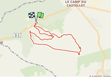

Length
9.8 km

Max alt
436 m

Uphill gradient
328 m
Km-Effort
14.2 km

Min alt
207 m

Downhill gradient
327 m
Boucle
Yes
Creation date :
2023-11-01 09:52:49.522
Updated on :
2023-11-01 16:55:03.33
3h13
Difficulty : Difficult

FREE GPS app for hiking
 SityTrail
IGN / Geographical institutes
SityTrail Plus
The world is yours!
About
Trail Walking of 9.8 km to be discovered at Provence-Alpes-Côte d'Azur, Var, Le Castellet. This trail is proposed by FSantoni.
Description
Beaucoup de pierriers.
Mais bien quand même.
Première rando (douce) avec les excursionnistes toulonnais
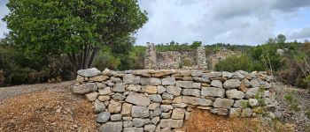
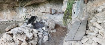
Photos


Positioning
Country:
France
Region :
Provence-Alpes-Côte d'Azur
Department/Province :
Var
Municipality :
Le Castellet
Location:
Unknown
Start:(Dec)
Start:(UTM)
721482 ; 4792111 (31T) N.
Comments