


Le tour du puy de Côme

jeanic63
User
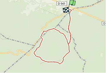

Length
8.6 km

Max alt
1049 m

Uphill gradient
235 m
Km-Effort
11.7 km

Min alt
927 m

Downhill gradient
227 m
Boucle
No
Creation date :
2023-11-06 13:11:20.928
Updated on :
2023-11-06 16:44:53.854
3h33
Difficulty : Medium

FREE GPS app for hiking
 SityTrail
IGN / Geographical institutes
SityTrail Plus
The world is yours!
About
Trail Walking of 8.6 km to be discovered at Auvergne-Rhône-Alpes, Puy-de-Dôme, Saint-Ours. This trail is proposed by jeanic63.
Description
départ au rond-point de vulcania
Positioning
Country:
France
Region :
Auvergne-Rhône-Alpes
Department/Province :
Puy-de-Dôme
Municipality :
Saint-Ours
Location:
Unknown
Start:(Dec)
Start:(UTM)
496110 ; 5073316 (31T) N.
Comments