


Bruno 080215

maginot
User

Length
14.9 km

Max alt
246 m

Uphill gradient
197 m
Km-Effort
17.6 km

Min alt
167 m

Downhill gradient
197 m
Boucle
Yes
Creation date :
2015-02-15 00:00:00.0
Updated on :
2015-02-15 00:00:00.0
1h33
Difficulty : Easy

FREE GPS app for hiking
 SityTrail
IGN / Geographical institutes
SityTrail Plus
The world is yours!
About
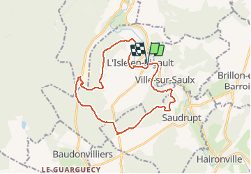
Trail Walking of 14.9 km to be discovered at Grand Est, Meuse, L'Isle-en-Rigault. This trail is proposed by maginot.
Description
Froid single super sympa
Positioning
Country:
France
Region :
Grand Est
Department/Province :
Meuse
Municipality :
L'Isle-en-Rigault
Location:
Unknown
Start:(Dec)
Start:(UTM)
650773 ; 5398009 (31U) N.
Comments