


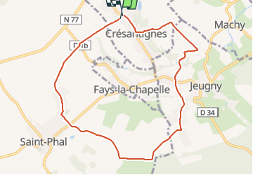
Cresantignes 23

bougnaou
User

Length
8.9 km

Max alt
185 m

Uphill gradient
103 m
Km-Effort
10.3 km

Min alt
144 m

Downhill gradient
111 m
Boucle
Yes
Creation date :
2023-11-19 08:00:43.715
Updated on :
2023-11-19 10:19:13.266
2h18
Difficulty : Easy

FREE GPS app for hiking
 SityTrail
IGN / Geographical institutes
SityTrail Plus
The world is yours!
About
Trail Walking of 8.9 km to be discovered at Grand Est, Aube, Crésantignes. This trail is proposed by bougnaou.
Positioning
Country:
France
Region :
Grand Est
Department/Province :
Aube
Municipality :
Crésantignes
Location:
Unknown
Start:(Dec)
Start:(UTM)
575610 ; 5332509 (31U) N.
Comments