


Mazee Adeps 19/11/2023

Luc Duc
User
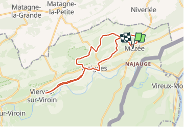

Length
14.7 km

Max alt
260 m

Uphill gradient
337 m
Km-Effort
19.2 km

Min alt
125 m

Downhill gradient
337 m
Boucle
Yes
Creation date :
2023-11-19 09:48:39.897
Updated on :
2023-11-19 12:55:02.783
3h01
Difficulty : Very difficult

FREE GPS app for hiking
 SityTrail
IGN / Geographical institutes
SityTrail Plus
The world is yours!
About
Trail Walking of 14.7 km to be discovered at Wallonia, Namur, Viroinval. This trail is proposed by Luc Duc.
Positioning
Country:
Belgium
Region :
Wallonia
Department/Province :
Namur
Municipality :
Viroinval
Location:
Unknown
Start:(Dec)
Start:(UTM)
621268 ; 5551197 (31U) N.
Comments