


savigny L'Arbresle

Jean-Marc C
User

Length
4.5 km

Max alt
316 m

Uphill gradient
62 m
Km-Effort
5.3 km

Min alt
281 m

Downhill gradient
51 m
Boucle
No
Creation date :
2023-11-19 14:58:26.097
Updated on :
2023-11-19 16:07:07.017
1h08
Difficulty : Easy

FREE GPS app for hiking
 SityTrail
IGN / Geographical institutes
SityTrail Plus
The world is yours!
About
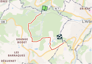
Trail Walking of 4.5 km to be discovered at Auvergne-Rhône-Alpes, Rhône, Savigny. This trail is proposed by Jean-Marc C.
Positioning
Country:
France
Region :
Auvergne-Rhône-Alpes
Department/Province :
Rhône
Municipality :
Savigny
Location:
Unknown
Start:(Dec)
Start:(UTM)
622956 ; 5077456 (31T) N.
Comments