


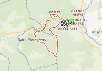
Antonave St Cyr gorges meouge par ponseur

Ponse
User

Length
17.4 km

Max alt
1339 m

Uphill gradient
1053 m
Km-Effort
31 km

Min alt
564 m

Downhill gradient
1063 m
Boucle
Yes
Creation date :
2023-11-22 09:49:38.0
Updated on :
2023-11-22 15:20:46.254
4h37
Difficulty : Difficult

FREE GPS app for hiking
 SityTrail
IGN / Geographical institutes
SityTrail Plus
The world is yours!
About
Trail Walking of 17.4 km to be discovered at Provence-Alpes-Côte d'Azur, Hautes-Alpes, Val-Buëch-Méouge. This trail is proposed by Ponse.
Positioning
Country:
France
Region :
Provence-Alpes-Côte d'Azur
Department/Province :
Hautes-Alpes
Municipality :
Val-Buëch-Méouge
Location:
Antonaves
Start:(Dec)
Start:(UTM)
723775 ; 4905361 (31T) N.
Comments