


A/R depuis le Val héré

latribuduchesnay
User

Length
4 km

Max alt
136 m

Uphill gradient
45 m
Km-Effort
4.6 km

Min alt
96 m

Downhill gradient
45 m
Boucle
Yes
Creation date :
2023-11-23 18:07:07.27
Updated on :
2023-11-23 18:07:08.737
1h02
Difficulty : Easy

FREE GPS app for hiking
 SityTrail
IGN / Geographical institutes
SityTrail Plus
The world is yours!
About
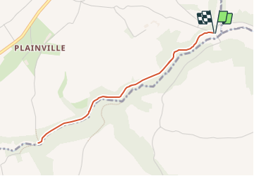
Trail Walking of 4 km to be discovered at Normandy, Calvados, Pierrefitte-en-Cinglais. This trail is proposed by latribuduchesnay.
Positioning
Country:
France
Region :
Normandy
Department/Province :
Calvados
Municipality :
Pierrefitte-en-Cinglais
Location:
Unknown
Start:(Dec)
Start:(UTM)
692754 ; 5418914 (30U) N.
Comments