


Saillans

raygautier
User
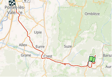

Length
62 km

Max alt
1075 m

Uphill gradient
1230 m
Km-Effort
79 km

Min alt
109 m

Downhill gradient
1403 m
Boucle
No
Creation date :
2023-11-23 07:32:43.0
Updated on :
2023-11-24 07:08:27.711

FREE GPS app for hiking
 SityTrail
IGN / Geographical institutes
SityTrail Plus
The world is yours!
About
Trail of 62 km to be discovered at Auvergne-Rhône-Alpes, Drôme, Saillans. This trail is proposed by raygautier.
Positioning
Country:
France
Region :
Auvergne-Rhône-Alpes
Department/Province :
Drôme
Municipality :
Saillans
Location:
Unknown
Start:(Dec)
Start:(UTM)
674294 ; 4951715 (31T) N.
Comments