


Entre Ouvèze & Aygues

MarcLEBARON
User
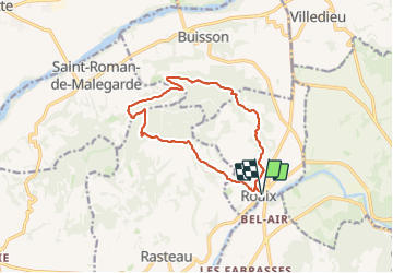

Length
13.1 km

Max alt
394 m

Uphill gradient
384 m
Km-Effort
18.2 km

Min alt
168 m

Downhill gradient
384 m
Boucle
Yes
Creation date :
2023-12-02 07:56:17.657
Updated on :
2024-01-08 12:31:54.864
4h08
Difficulty : Difficult

FREE GPS app for hiking
 SityTrail
IGN / Geographical institutes
SityTrail Plus
The world is yours!
About
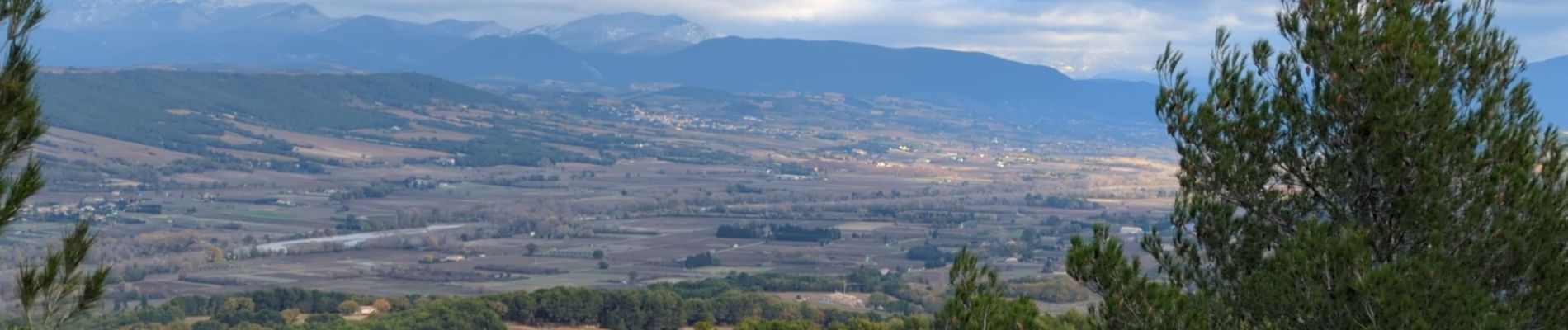
Trail Walking of 13.1 km to be discovered at Provence-Alpes-Côte d'Azur, Vaucluse, Roaix. This trail is proposed by MarcLEBARON.
Photos


Positioning
Country:
France
Region :
Provence-Alpes-Côte d'Azur
Department/Province :
Vaucluse
Municipality :
Roaix
Location:
Unknown
Start:(Dec)
Start:(UTM)
660955 ; 4900918 (31T) N.
Comments