


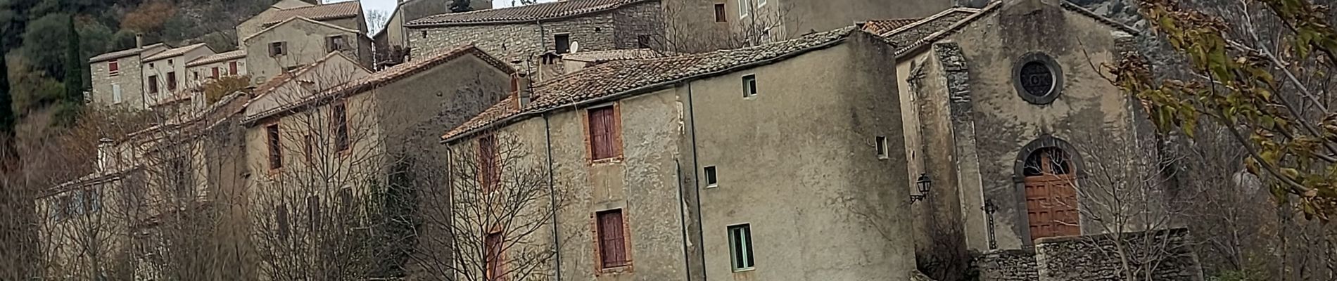
saint Maurice de navacelles

labarone
User
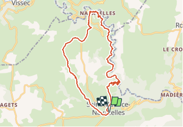

Length
21 km

Max alt
679 m

Uphill gradient
629 m
Km-Effort
29 km

Min alt
264 m

Downhill gradient
629 m
Boucle
Yes
Creation date :
2023-12-05 08:03:58.274
Updated on :
2023-12-05 14:54:20.587
6h14
Difficulty : Difficult

FREE GPS app for hiking
 SityTrail
IGN / Geographical institutes
SityTrail Plus
The world is yours!
About
Trail Walking of 21 km to be discovered at Occitania, Hérault, Saint-Maurice-Navacelles. This trail is proposed by labarone.
Description
belle rando
mais prudence car passage étroit pierreux et côté pentu
aujourd'hui vent et petite pluie
prévoir de quoi se protéger en décembre et
Photos


Positioning
Country:
France
Region :
Occitania
Department/Province :
Hérault
Municipality :
Saint-Maurice-Navacelles
Location:
Unknown
Start:(Dec)
Start:(UTM)
541763 ; 4854859 (31T) N.
Comments