


SityTrail - Extratrail_stavelot_13km_new

Efr
User
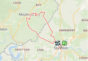

Length
13.4 km

Max alt
510 m

Uphill gradient
477 m
Km-Effort
19.8 km

Min alt
281 m

Downhill gradient
477 m
Boucle
Yes
Creation date :
2023-12-06 22:03:49.286
Updated on :
2023-12-06 22:10:32.09
4h29
Difficulty : Very difficult

FREE GPS app for hiking
 SityTrail
IGN / Geographical institutes
SityTrail Plus
The world is yours!
About
Trail Walking of 13.4 km to be discovered at Wallonia, Liège, Stavelot. This trail is proposed by Efr.
Description
Parcours bleu
Distance 13,5 km
Dénivelé 478 m
Durée 1h30 à 2h30
Difficulté
Départ :
Office du Tourisme (Cour de l'Abbaye 1 - 4970 Stavelot)
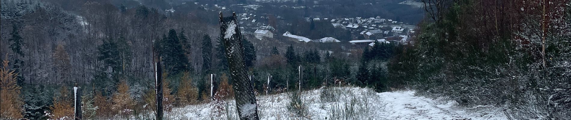
Photos


Positioning
Country:
Belgium
Region :
Wallonia
Department/Province :
Liège
Municipality :
Stavelot
Location:
Unknown
Start:(Dec)
Start:(UTM)
708379 ; 5586513 (31U) N.
Comments