st saturnin tilleret-10-12-23

papou73
User

Length
7.6 km

Max alt
556 m

Uphill gradient
306 m
Km-Effort
11.7 km

Min alt
316 m

Downhill gradient
307 m
Boucle
Yes
Creation date :
2023-12-10 13:18:37.425
Updated on :
2023-12-10 16:05:23.607
2h24
Difficulty : Medium

FREE GPS app for hiking
 SityTrail
IGN / Geographical institutes
SityTrail Plus
The world is yours!
About
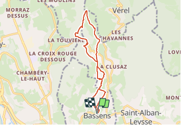
Trail Walking of 7.6 km to be discovered at Auvergne-Rhône-Alpes, Savoy, Bassens. This trail is proposed by papou73.
Positioning
Country:
France
Region :
Auvergne-Rhône-Alpes
Department/Province :
Savoy
Municipality :
Bassens
Location:
Unknown
Start:(Dec)
Start:(UTM)
729424 ; 5051813 (31T) N.
Comments