


Autour du pic saint loup

labarone
User

Length
16.1 km

Max alt
645 m

Uphill gradient
811 m
Km-Effort
27 km

Min alt
135 m

Downhill gradient
813 m
Boucle
Yes
Creation date :
2023-12-12 07:29:20.254
Updated on :
2023-12-12 15:42:51.685
7h39
Difficulty : Difficult

FREE GPS app for hiking
 SityTrail
IGN / Geographical institutes
SityTrail Plus
The world is yours!
About
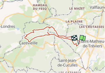
Trail Walking of 16.1 km to be discovered at Occitania, Hérault, Saint-Mathieu-de-Tréviers. This trail is proposed by labarone.
Description
que des cailloux, et aussi terrain ravinés et glissants
Mais contents de l'effort
Photos


Positioning
Country:
France
Region :
Occitania
Department/Province :
Hérault
Municipality :
Saint-Mathieu-de-Tréviers
Location:
Unknown
Start:(Dec)
Start:(UTM)
568260 ; 4846540 (31T) N.
Comments