


Arronville wmenouville

avdem
User
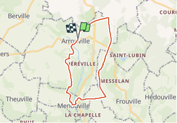

Length
13 km

Max alt
130 m

Uphill gradient
162 m
Km-Effort
15.2 km

Min alt
57 m

Downhill gradient
168 m
Boucle
Yes
Creation date :
2023-12-14 08:19:02.878
Updated on :
2023-12-19 11:07:10.987
3h00
Difficulty : Easy

FREE GPS app for hiking
 SityTrail
IGN / Geographical institutes
SityTrail Plus
The world is yours!
About
Trail Walking of 13 km to be discovered at Ile-de-France, Val-d'Oise, Arronville. This trail is proposed by avdem.
Description
Facile
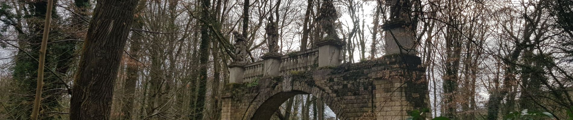
Photos


Positioning
Country:
France
Region :
Ile-de-France
Department/Province :
Val-d'Oise
Municipality :
Arronville
Location:
Unknown
Start:(Dec)
Start:(UTM)
435418 ; 5447985 (31U) N.
Comments