


Presles

crocau
User
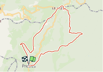

Length
10.4 km

Max alt
1133 m

Uphill gradient
331 m
Km-Effort
14.9 km

Min alt
846 m

Downhill gradient
335 m
Boucle
Yes
Creation date :
2023-12-26 13:20:25.482
Updated on :
2023-12-26 15:52:56.69
2h26
Difficulty : Easy

FREE GPS app for hiking
 SityTrail
IGN / Geographical institutes
SityTrail Plus
The world is yours!
About
Trail Mountain bike of 10.4 km to be discovered at Auvergne-Rhône-Alpes, Isère, Presles. This trail is proposed by crocau.
Description
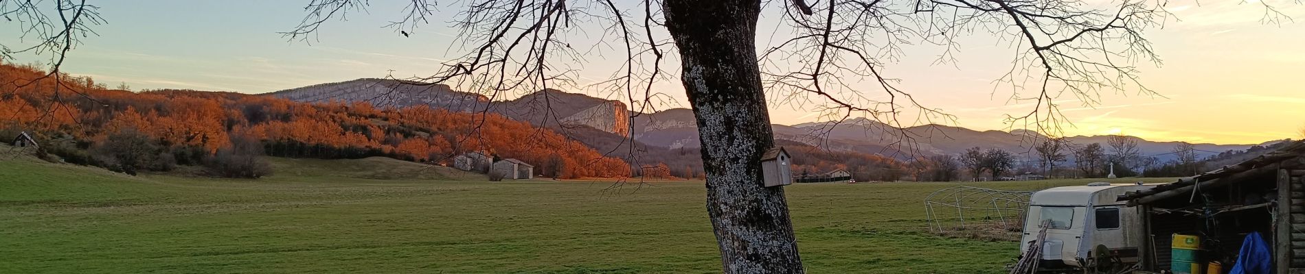
rando VTT magnifique
Photos


Positioning
Country:
France
Region :
Auvergne-Rhône-Alpes
Department/Province :
Isère
Municipality :
Presles
Location:
Unknown
Start:(Dec)
Start:(UTM)
687487 ; 4995884 (31T) N.
Comments
superbe rando VTT !!