Trail  Bénivay-Ollon - 2024-01-07_22h57m03_tmpWriteApidae_353823_fr - Photo

2024-01-07_22h57m03_tmpWriteApidae_353823_fr

 losjo
losjo

User

© OpenStreetMap contributors
Length
Length
17 km
Max alt
Max alt
904 m
Uphill gradient
Uphill gradient
663 m
Km-Effort
Km-Effort  
26 km
Min alt
Min alt
487 m
Downhill gradient
Downhill gradient
661 m
Boucle
Boucle
Yes
Creation date :
2024-01-07 21:57:03.742
Updated on :
2024-01-07 21:57:05.754

(0 Reviews)


Scan this QR Code to open this trail in the SityTrail application

FREE GPS app for hiking

Logo SityTrail SityTrail

IGN / Geographical institutes

Download SityTrail from the App Store Download SityTrail from Google Play

Logo SityTrail SityTrail Plus

The world is yours!

Download SityTrail from the App Store Download SityTrail from Google Play Download SityTrail on Huawei AppGallery

About

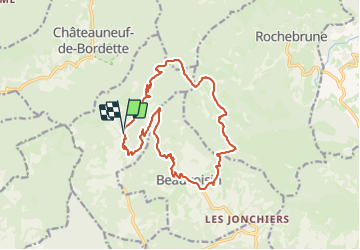
Trail of 17 km to be discovered at Auvergne-Rhône-Alpes, Drôme, Bénivay-Ollon. This trail is proposed by losjo.

Description

Longue randonnée dont chaque col franchi offre des vues variées, permettant de découvrir la vallée de l'Eygue-Marse, le nord des Baronnies, les hameaux de Beauovisin, ainsi qu'un point de vue sur le Mont Ventoux.

Elevation profile

Positioning

Country:
France
Region :
Auvergne-Rhône-Alpes
Department/Province :
Drôme
Municipality :
Bénivay-Ollon
Location:
Unknown
Start:(UTM)
674513 ; 4909001 (31T) N.


Close
My subscriptions