


Resteigne

fra_depoorter
User
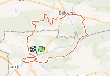

Length
10.3 km

Max alt
287 m

Uphill gradient
252 m
Km-Effort
13.7 km

Min alt
170 m

Downhill gradient
252 m
Boucle
Yes
Creation date :
2024-01-10 12:44:43.244
Updated on :
2024-01-10 15:38:56.137
2h53
Difficulty : Medium

FREE GPS app for hiking
 SityTrail
IGN / Geographical institutes
SityTrail Plus
The world is yours!
About
Trail Walking of 10.3 km to be discovered at Wallonia, Luxembourg, Tellin. This trail is proposed by fra_depoorter.
Positioning
Country:
Belgium
Region :
Wallonia
Department/Province :
Luxembourg
Municipality :
Tellin
Location:
Unknown
Start:(Dec)
Start:(UTM)
655714 ; 5551058 (31U) N.
Comments