


Rochehaut 110124

guyernage25
User
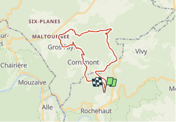

Length
13.5 km

Max alt
429 m

Uphill gradient
337 m
Km-Effort
17.9 km

Min alt
254 m

Downhill gradient
336 m
Boucle
Yes
Creation date :
2024-01-11 09:31:44.408
Updated on :
2024-01-11 13:16:53.572
3h43
Difficulty : Easy

FREE GPS app for hiking
 SityTrail
IGN / Geographical institutes
SityTrail Plus
The world is yours!
About
Trail Walking of 13.5 km to be discovered at Wallonia, Luxembourg, Bouillon. This trail is proposed by guyernage25.
Description
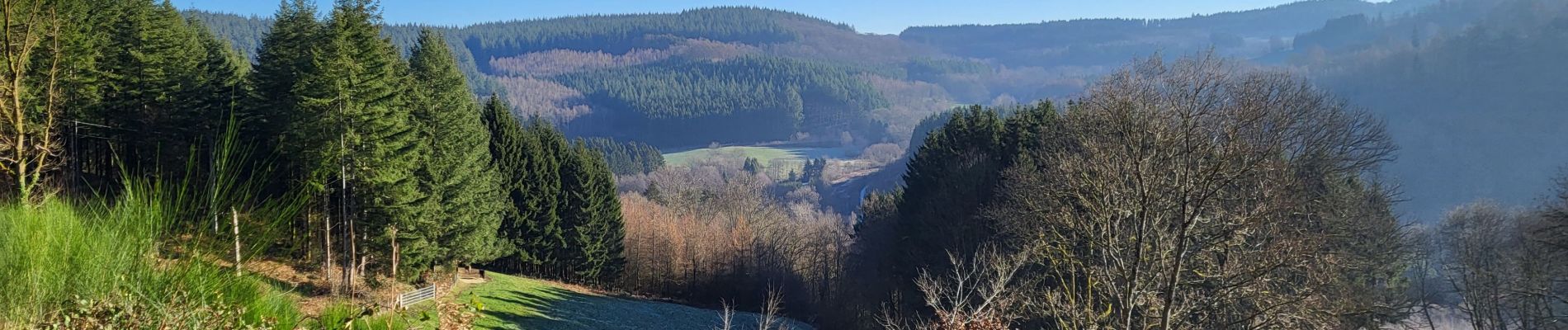
belle balade forestiere
Photos


29 photos in total. Please click on a photo to see them all in the gallery.
Positioning
Country:
Belgium
Region :
Wallonia
Department/Province :
Luxembourg
Municipality :
Bouillon
Location:
Unknown
Start:(Dec)
Start:(UTM)
644734 ; 5523744 (31U) N.
Comments